
As I begin writing this, I can’t quite believe that it was a week ago on Friday that we arrived on the Eyre Peninsula. We made two main stopovers on the Peninsula, the first at the little town of Streaky Bay, 100kms from Ceduna, on the western side of the Peninsula. Streaky Bay is well protected from rough weather conditions, and was given this name in 1802 by Matthew Flinders because when he first saw the Bay, the water was discoloured with streaks that are apparently caused by the release of oils by certain seaweeds living in the Bay.
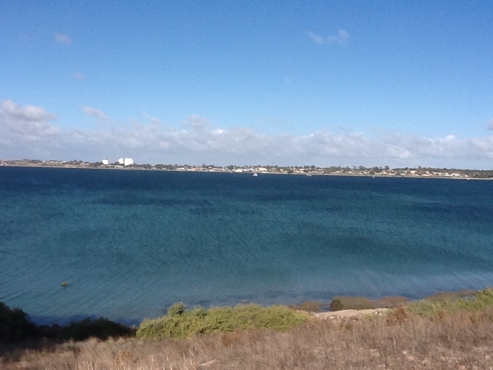
Looking across the bay to the township of Streaky Bay – and good weather later in the day
Today Streaky Bay is the centre of an agricultural district farming grain crops and sheep, as well as supporting fishing and tourism.
We certainly enjoyed the delights of the 2 main cafes in town – they make great soups and gluten free meals. Unfortunately we didn’t always get the best weather whilst there, experiencing quite squally winds and showers and it was cool. However it didn’t inhibit our exploring the rugged west coast shoreline which is really quite spectacular – Cape Bauer with its huge waves crashing into the cliffs, having carved out vast areas so that you are literally suspended above the sea; the Whistling Rocks and Blowholes that dominate a huge area of the cliffs and yes you do see the water spouting into the sky; Sceale Bay and its sea lion population; and then the Westall Way Loop with its magnificent surf beaches with not a soul in sight, the High Cliff where we walked along the cliff edge (sensibly folks) to the islands at the point, the Granites (thousands of granite boulders) which were formed millions of years ago,
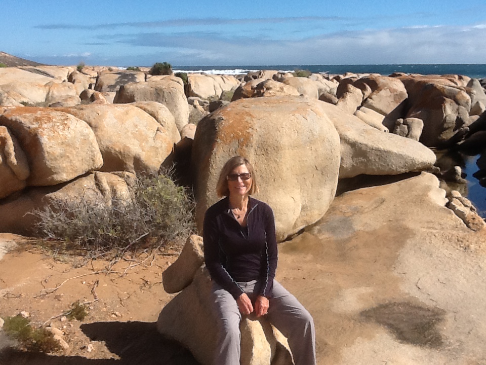
Resting briefly at the Granites
and the Smooth Pool – an eroding granite shelf extending several hundred metres, fully exposed to the might of the Southern Ocean and at low tide studded with deep rock pools that at the right time of year are enjoyed by many a swimmer and picnicker. We thoroughly enjoyed this geographic wonderland and of course we know we didn’t see everything.
From Streaky Bay we moved south 270kms to Coffin Bay, which is still on the west coast of the Peninsula and just 46kms from Port Lincoln. On the way we stopped off at Venus Bay, another very protected bay, with its attractive conservation areas, excellent fishing and a lovely little caravan park on the water; and Elliston, on the shores of Waterloo Bay, also known for its magnificent rugged and scenic coastline. As with Streaky Bay, the Eyre Peninsula is known for its grain growing, interspersed with sheep farming. What’s noticeable on the west coast is the very rocky ground, and just how well farmers make use of their land.
We decided to base ourselves further south at Coffin Bay because it is known for its National Parks, its sheltered bays of Port Douglas, and its an easy day trip to Port Lincoln at the southern tip of the Peninsula. We enjoyed 3 nights here and really did make the most of it, exploring the area and the Port, however again, it was cool temps and strong winds with passing showers. This cooler weather isn’t our favourite, but we just get out there and make the most of it.
Coffin Bay is very well known in Australia for its oysters. Historically the area was known as Oystertown. In 1849 its widely believed there were up to 30 cutters dredging native Angasi oysters in the Bay. Sadly these were wiped out, albeit its not truly known why, in the late 1800s and today the Pacific Oyster is farmed in the Bay, albeit the Angasi is starting to make a comeback. The Bay is also very popular for its fishing and interesting walks.The town itself supports a small permanent population of some 600, with up to 4000+ over the summer months.
The Coffin Bay National Park is the largest and we truly felt there was no one else for miles as we explored a number of bays and 4 wheel drive tracks.
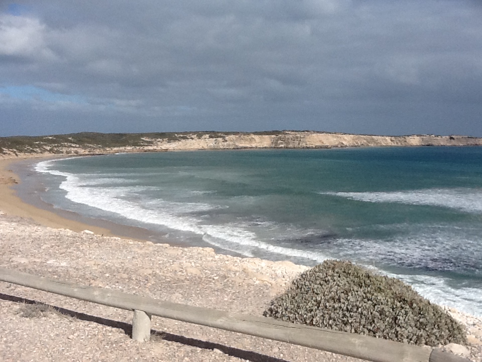
Beautiful white sands of the beaches on the west coast of the national park
Point Avoid and its rugged yet spectacular cliffs on the seaward side of the park, contrasting with the flat waters of Yangie Bay inside the Port, Gunya Beach which is reached by driving on a rough rocky road that is more like a goat track, and then you walk a kilometre over massive sand dunes where you could get lost if you weren’t careful – especially when your footsteps are gone within 30 minutes because of the sand blasting in the wild wind – and the many bays and Capes across the Peninsula.
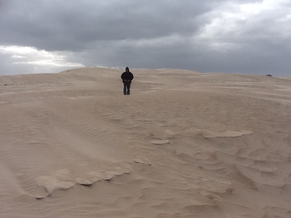
I think that’s Steve in the sand dunes
When we climbed and wrestled with the sand dunes we must have looked a sight – layers, wind jackets, hoods over our heads, battling the wind and the sand, we were determined to get there. Instructions said you could drive from the road to the beach – we weren’t going to try this out. These dunes are huge, the sand is deep and you are in the middle of nowhere, with just the kangaroos and emus as company….yes we saw lots of wildlife on the way. We had a great time.
Of course we spent a day in and around Port Lincoln. As well as major grain handling facilities, the town is home of Australia’s largest commercial fishing fleet. We were blown away by the scale of fishing operations based here – tuna, kingfish, abalone, mussels and oysters are the mainstay. When you see fishing boat upon fishing boats its quite something.
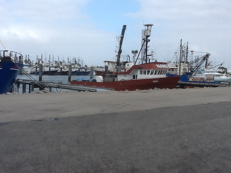
Just a small percentage of the fishing fleet
You can swim with tuna at the offshore tuna farms and with the great whites – yes tempted, but when its 14 degrees with winds up to 40 knots, and yes its raining, then its not such a hard decision to say ‘not today’. There are around 14,000 living here and apparently there are more millionaires per capita than anywhere else in Australia! The town is built on the side of a hill, levelling to flat on the bay, offering all the major services and facilities of most cities in Australia. The coastal landscape is really contrasting – sheltered waters with a small city beach, very rugged coastline and surf beaches. There wasn’t much coastal activity to be had when we were there, however we did enjoy looking around.

This concrete and mosaic seat and foot stool in town appealed – note the woolly jumper, the 3rd layer
Following our stay at Coffin Bay we travelled up the east coast of the Peninsula, passing through Tumby Bay and the small town of Cowell, to stop over at the steel township of Whyalla for the night. This was really just a convenience stopover as we didn’t fancy staying at Port Augusta, another 75kms north, the junction before traveling down the coast toward Adelaide. We’ve stayed there before and it doesn’t rate highly on our list of ‘must stays’. So Whyalla it was. For those who don’t know, Whyalla has a long history of exporting steel, having been founded in the early 1900s by BHP. Today Arrium (previously One Steel) has significant operations here, and as a result the city has 22,000 residents. One wonders just what impact current economic events will have on the success of the town.
From Whyalla we have travelled to Clare, and the Clare Valley, arriving here just in time for the Clare Valley Gourmet Weekend. Oh what perfect timing. More about that in our next Blog!
