Last Thursday we left Port Hedland nice and early, heading for Karijini National Park. Because the road we travelled connects Port Hedland to Newman we knew we should expect lots of road trains commuting between the Port and the mine site. So, as you do, we decided to count the oncoming road trains and work out how many we passed each hour…..it was one every two minutes. So combine this with those in front of and behind us, and yes, it’s more than one a minute. Quite astounding, a very busy road. We were also fascinated by the number of dead cows on the side of the road – because many stations are not fenced due to cost, they risk loosing stock on the roads. Over 200kms there must have been at least 40 carcases, worth close to $40,000….a huge loss for the station owners!
Our first stop was at Albert Tognolini free camp, just off the highway and at the side of the national park. What a delightful stopover. We arrived before noon, and had a relaxing afternoon and evening enjoying stunning views across the hills and escarpments. It wasn’t too hard to handle.
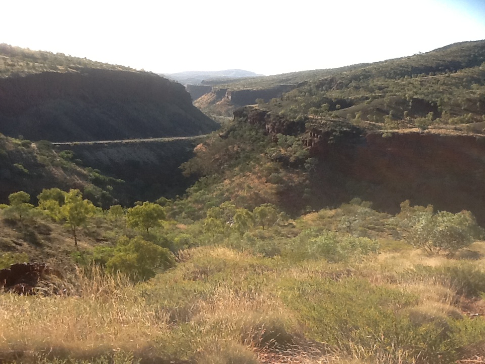
The view down to the highway from Albert Tognolini free camp area
Camping areas are well spaced so that no one needs to even be aware of their neighbours. Early afternoon we went for a walk and on our return were confronted by what looked like a road train coming up the hill…..and then it parked in the same area as us. We learned that this was indeed a camper, built in a semi trailer, owned by a lovely QLD couple Alan and Linda. Its amazing the range and scale of buses and campers we meet on the road!
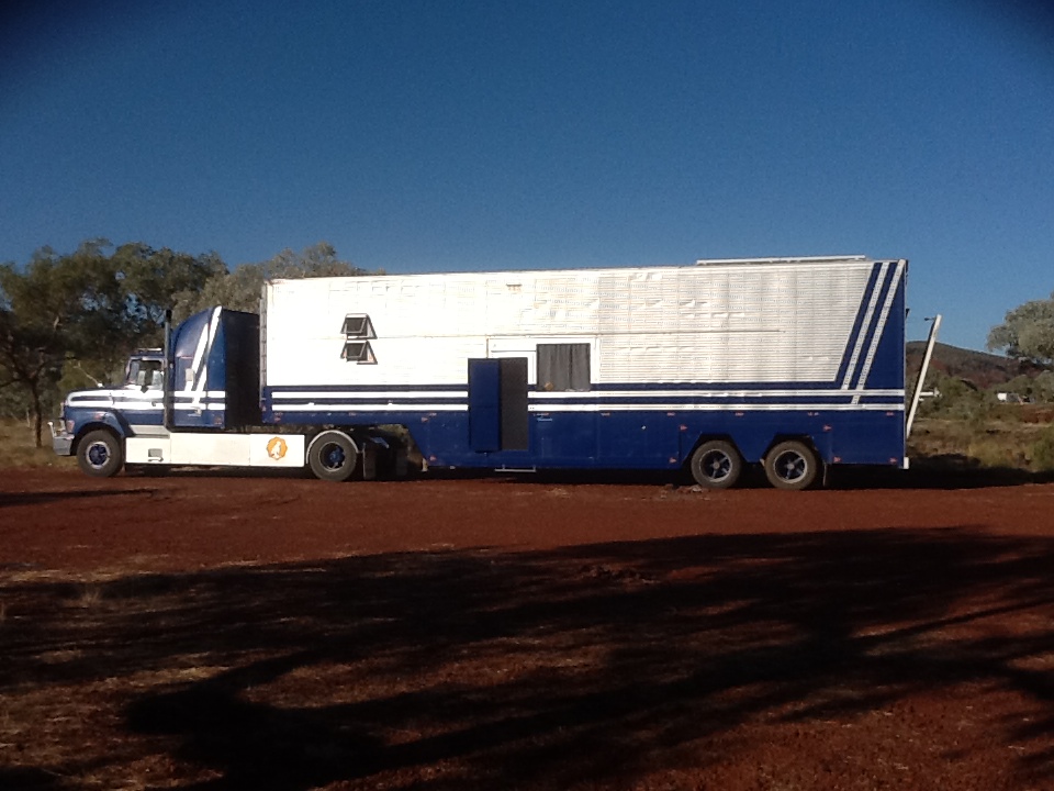
This huge semi trailer is actually a camper!
On Friday we ventured into Karijini to Dales camp ground. Thankfully this is a national park camp that is at the end of a sealed road. We were so lucky! There is an area that is designated for coaches (tourist version) and because there were none due for 5 days we were able to park here, a separate area from the rest of the camp ground. The sites are huge and well spaced, there are dedicated b’bcues and toilets and it is quiet. This was a fantastic spot, so much so we extended from 2 to 3 nights.
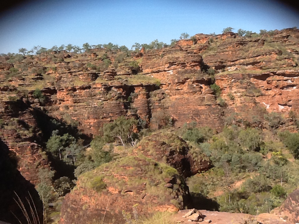
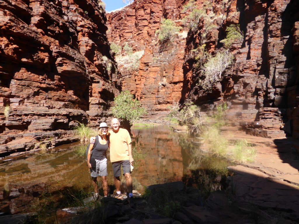
There are a number of gorges in Karijini and with 3 days we wanted to walk as many as we could. Karijini was formed over 2500 million years ago as iron and silica-rich sediment deposits accumulated on an ancient sea floor. When you drive into the park its easy to question ‘where are these gorges?’, because the landscape doesn’t look like there could be any! Small creek beds are hidden in the rolling hillsides, suddenly plunging down 100 metre chasms. These gorges become wider, with sheer cliffs changing to steep slopes of loose rock dropping down to dramatic waterfalls and clear fresh pools. Quite simply they are amazing. On Friday afternoon we walked to Dales Gorge, home of the Fortescue Falls, the Fern Pool and the Circular Pool.

Looking down on Fortescue Falls
We walked down to the Falls which are quite beautiful and after soaking up the atmosphere walked 300m along to the Fern Pool. Wow, this is a glorious and large fresh water pool at the bottom of low falls, surrounded by ferns and trees creating a tranquil oasis that is hidden away from the main event. We just had to have a swim despite the fresh cool water! It was beautiful, but just a little fresh. I wonder why we were the only ones in the water!
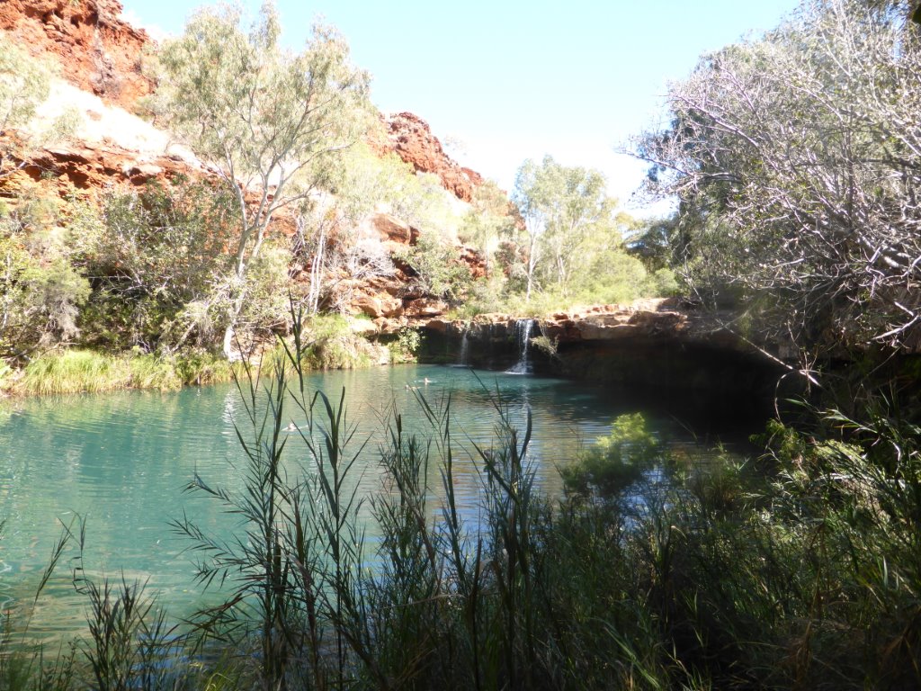
The Fern Pool
Following a light lunch, it was down into the gorge, to walk through to the Circular Pool, a kilometre downstream. After a scramble back up the cliff face, and a stroll back to base, we relaxed for the rest of the afternoon, planning our jaunts of the next two days.
Over the next 2 days we visited and conquered Knox. Joffre, Hancock, Weano and Kalamina Gorges. The first four of these are class 5 trails – that is difficult with a high degree of fitness required….we must be fitter than we thought! Each gorge has its own beauty. Knox has a very steep descent, with lots of loose scree, and the meandering waters and pools in the gorge lead to a narrow pool at the end that is just made for skinny dipping.
The bottom end of Knox Gorge
There was no one else there so I just had to jump in! Brrrhh, it was a bit chilly.
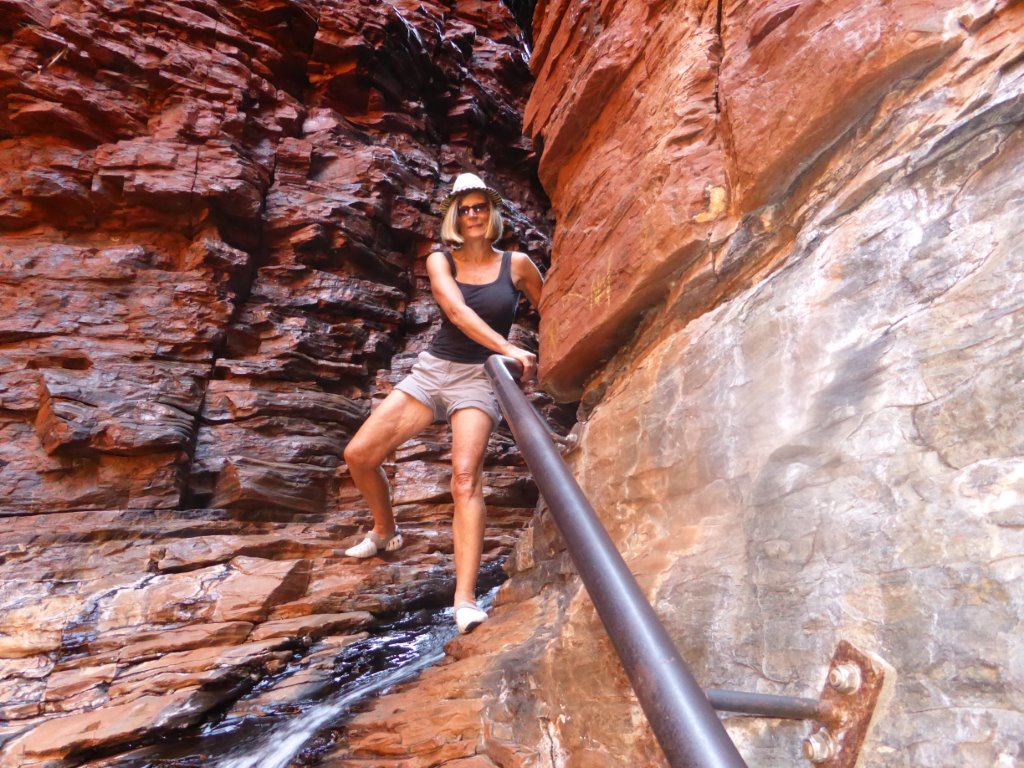
Hancock has the crazy spider walk, leading to Kermits Pool.

Jane doing the spider walk in Hancock Gorge
We had heard about this gorge. Its a rapid descent into the gorge, followed by thigh high pool crossings, that lead to the spider walk through a 50m very narrow water filled chasm, cliff climbing using small hand and foot holds, ending at Kermits Pool. We were a bit sceptical about the spider walk – could we do it? Yes we could! Our muscles had a good workout, and despite being a little wet we had big smiles on our faces as we climbed back out of the gorge on to our next venture, mastering Weano Gorge. Weano Gorge is deceptive, it is an easy climb down to the gorge itself, and you can take a relatively easy walk through the gorge, or you can tackle more water, clamber along rock faces using tiny hand and foot holds, and then gingerly walk along very smooth rock to the Handrail Pool – which is a deep pool reached by climbing down rock steps, straddling the handrail.
Jane climbing down to the Handrail Pool
And it doesn’t end there. If you are brave enough, it’s into the icy cold water for a swim through a long and narrow chasm to another pool. Fantastic but cold! And then you have to get back again and climb the rock face back out of the gorge. And yes we didn’t take the easy option! Phew, lots of energy expended but so much fun!
Our last day at Karijini was light in comparison to the earlier days, with just a walk through the Kalamina Gorge. We knew it would be a little easier given it’s a class 4 trail. Down the escarpment to the gorge floor, the walk criss crosses the bubbling waters of the streams, and there are only a couple of scrambles along rock faces, before arriving at the pool at the end of the gorge.
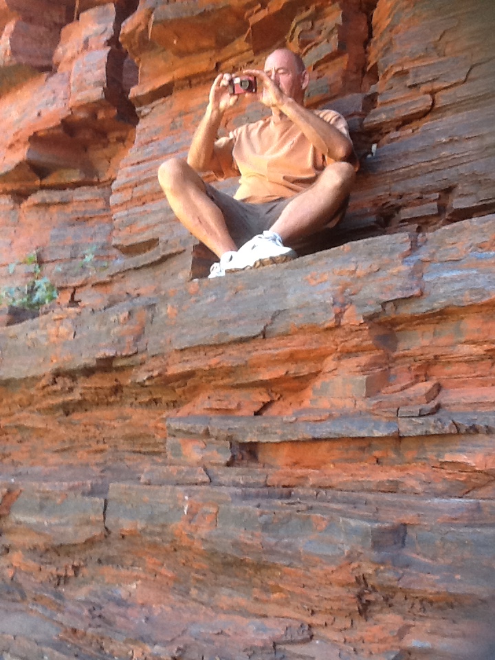
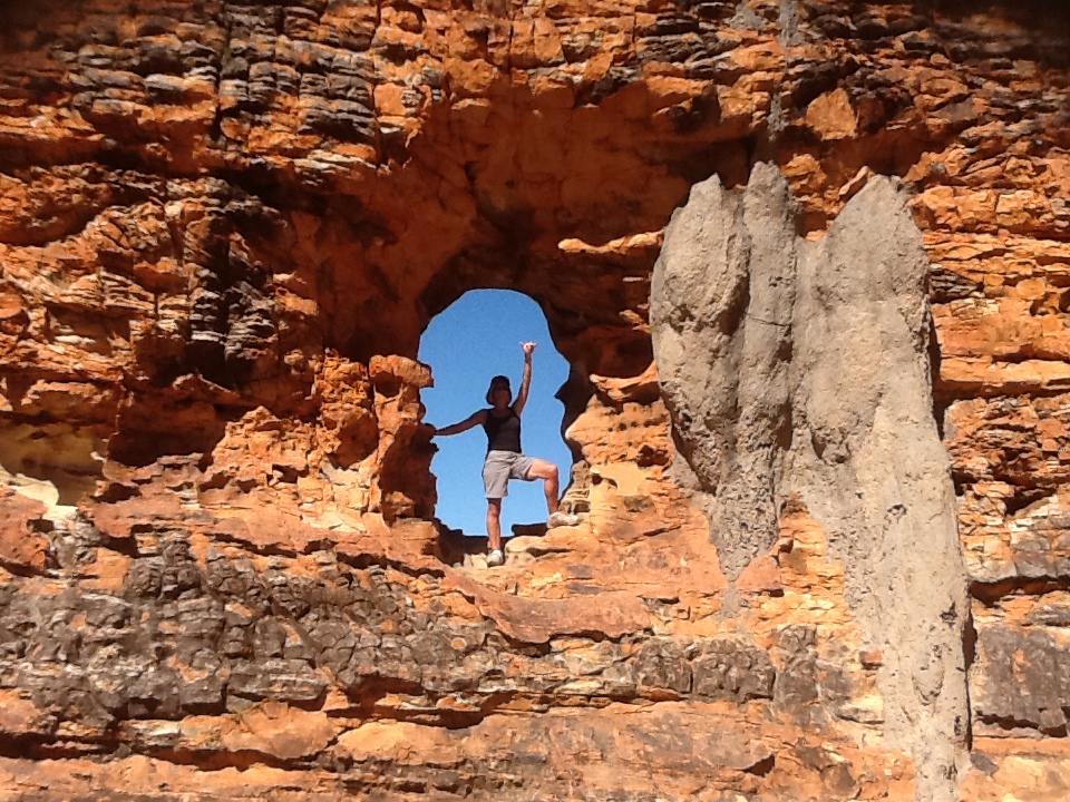
Steve taking a photo before climbing through ‘the window’ at Kalamina Gorge
To get to the swimming pool there is a cliff climb through a ‘window’. We didn’t swim, choosing rather to enjoy the scenery and peace and quiet of the morning. We had the gorge to ourselves for most of the walk. Unfortunately on our way back to camp we got a puncture, and Mr McGiver had to get his tools out and make a swift change back at base.
It was hard to leave the scenic beauty of Karijini, which had been a real surprise to us and it’s clear that it’s not well publicised. We wouldn’t have detoured to the park if it wasn’t for fellow travellers who shared their experiences and noted it as a must visit destination.
On Monday morning we hit the road, with our first stop of the day planned for Tom Price, a Rio Tinto mining town that was established in the early 1960s when iron ore was discovered by the American Tom Price. We needed to get our Suzuki puncture fixed and were lucky enough to get it done straight away at the first place we tried. After a quick look around we hit the road again. Some 400kms later we stopped for the day, and travelled the last 200kms on Tuesday morning. Now I have a confession to make. As the chief navigator it’s my responsibility to book camp grounds when we choose to stay in them. I duly met my responsibilities for Exmouth and booked the camp ground…..but it was the wrong one. We rocked up to the Ningaloo Lighthouse Caravan Park to be told we had no booking. Not good! And the driver wasn’t too happy. So some quick footwork and conversation and thankfully we had everything sorted and have booked for a week here. We’re in the overflow area in the best spot, with beach and sea views and our own amenity block….and there’s just us and one other van! How good can it get. We have a whole week to play in this world heritage area that offers snorkelling on the reef, swimming with whale sharks and beautiful clear waters for swimming. What a week! And here’s a wee tempter….
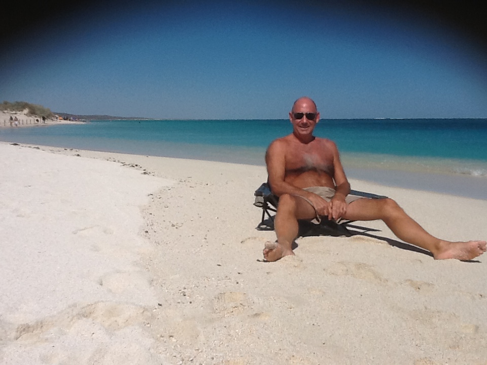
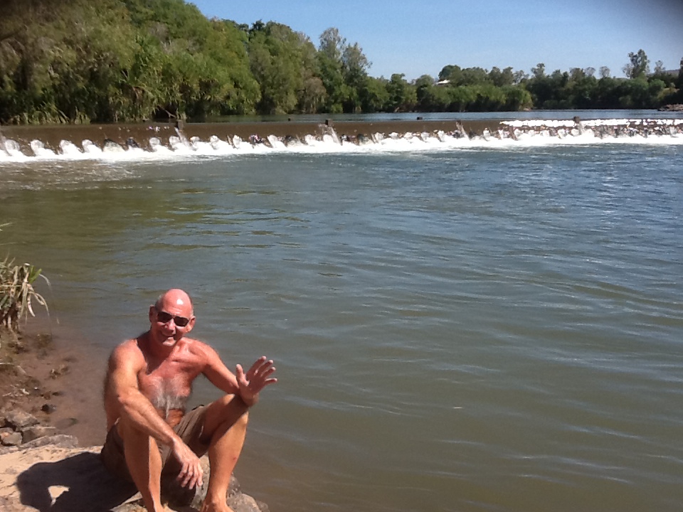
Steve enjoying the tranquillity of Turquoise Bay, Ningaloo Reef, this afternoon